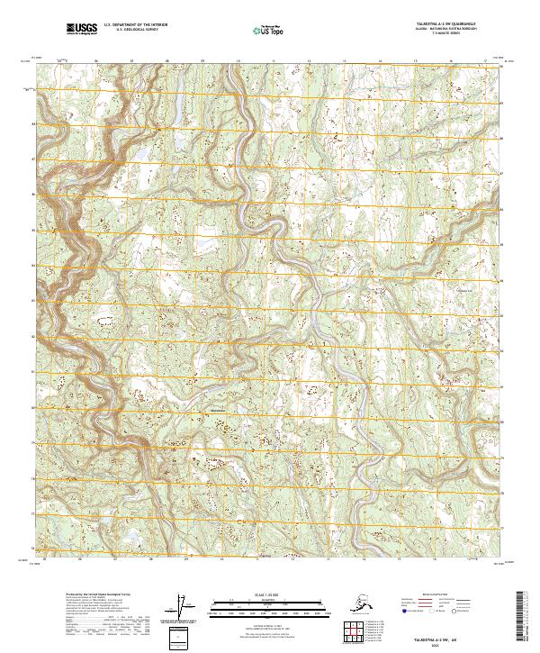
2023 Map of Talkeetna A-2 SW
USGS Topo · Published 2023About this map
Skwentna sits at the heart of this Susitna Valley landscape, marking a vital point of habitation in a region defined by its complex drainage systems. The Kahiltna River dominates the central corridor, winding through a terrain where the braiding of glacial meltwaters creates a shifting, intricate geography. In the northwest, Lake Creek flows through the township of T24N R9W, while Beaver Creek and Fish Lake Creek offer a glimpse into the seasonal hydrology that governs travel and subsistence in this part of the Matanuska-Susitna Borough. The inclusion of Traleika Col in the east highlights the transition into more prominent topographical elevations. This 2023 edition reflects modern survey data while preserving the locations of remote outposts and traditional waterways essential for Alaskan backcountry navigation.
Find a feature on this map
12 named features on this map. Tap any name to fly to it.
Don’t see what you’re looking for? This feature index may not catch every label — zoom into the map to look around manually.
Map Details
Editions of this 2023 Talkeetna A-2 SW Map
This is the sole edition of this map. No revisions or reprints were ever made.
Other maps of this area

1949 · Tyonek
USGS Topo · 1:250,000

1950 · Talkeetna
USGS Topo · 1:250,000

1951 · Talkeetna
USGS Topo · 1:250,000

1951 · Tyonek
USGS Topo · 1:250,000

1954 · Tyonek D-2
USGS Topo · 1:63,360

1954 · Tyonek D-3
USGS Topo · 1:63,360

1954 · Talkeetna A-3
USGS Topo · 1:63,360

1954 · Talkeetna A-2
USGS Topo · 1:63,360

1958 · Tyonek
USGS Topo · 1:250,000

1958 · Talkeetna
USGS Topo · 1:250,000