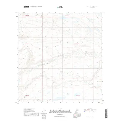
2017 Map of Talkeetna A-4 SW
USGS Topo · Published 2017About this map
Johnson Creek and Red Cr define the intricate drainage patterns of this Alaskan landscape within the Talkeetna A-4 SW quadrangle. The terrain is characterized by numerous kettle-like depressions and elongated ridges, typical of glacial topography, which shelter smaller water bodies such as Patrick Lake and Tranquility Lake. The absence of roads or permanent settlements in this portion of the Matanuska-Susitna Borough emphasizes the wilderness character of the region. Surveyed by the U.S. Geological Survey, the map provides a detailed look at the township and range boundaries including t23n r14w and t24n r15w, which serve as primary reference points for land navigation and resource management in the vast interior. This map is a critical resource for understanding the undisturbed natural hydrology and landform distribution in the area north of the Susitna River valley.
Find a feature on this map
10 named features on this map. Tap any name to fly to it.
Don’t see what you’re looking for? This feature index may not catch every label — zoom into the map to look around manually.
Map Details
Editions of this 2017 Talkeetna A-4 SW Map
This is the sole edition of this map. No revisions or reprints were ever made.
Other maps of this area

1949 · Tyonek
USGS Topo · 1:250,000

1950 · Talkeetna
USGS Topo · 1:250,000

1951 · Talkeetna
USGS Topo · 1:250,000

1951 · Tyonek
USGS Topo · 1:250,000

1954 · Tyonek D-5
USGS Topo · 1:63,360

1954 · Talkeetna A-4
USGS Topo · 1:63,360

1958 · Tyonek D-6
USGS Topo · 1:63,360

1958 · Talkeetna A-5
USGS Topo · 1:63,360

1958 · Tyonek
USGS Topo · 1:250,000

1958 · Talkeetna
USGS Topo · 1:250,000