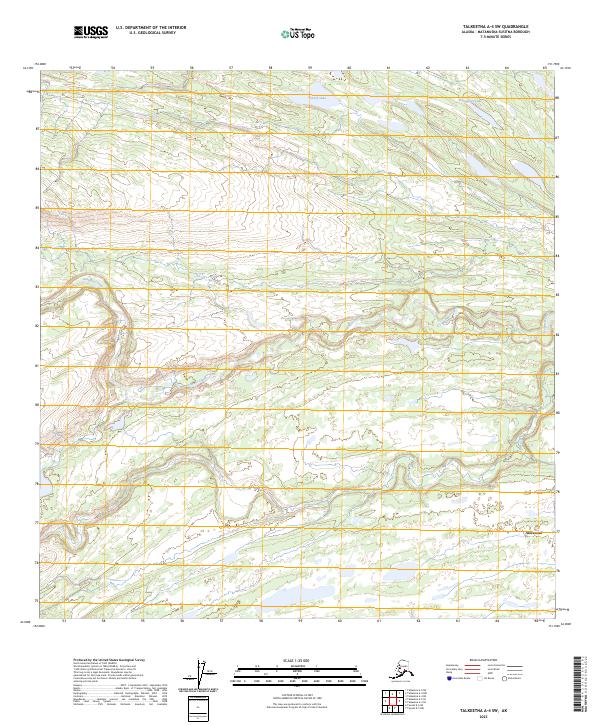
2023 Map of Talkeetna A-4 SW
USGS Topo · Published 2023About this map
Skwentna sits at the southern edge of this Matanuska-Susitna interior landscape, marking a vital point of human presence in a territory defined by its winding waterways. The hydrology here is complex, with the braided path of Johnson Creek cutting across the central terrain and Red Creek traversing the southern reaches. These watercourses are the primary geographical anchors in a region largely devoid of road infrastructure, reflecting the importance of river systems for navigation and settlement in the Alaska bush. To the north, Patrick Lake and Tranquility Lake are positioned among the higher elevations, providing clear markers for pilots and travelers moving through the Skwentna River valley. The grid of township and range lines, such as t23n r14w, illustrates the systematic federal survey of these remote reaches.
Find a feature on this map
11 named features on this map. Tap any name to fly to it.
Don’t see what you’re looking for? This feature index may not catch every label — zoom into the map to look around manually.
Map Details
Editions of this 2023 Talkeetna A-4 SW Map
This is the sole edition of this map. No revisions or reprints were ever made.
Other maps of this area

1949 · Tyonek
USGS Topo · 1:250,000

1950 · Talkeetna
USGS Topo · 1:250,000

1951 · Talkeetna
USGS Topo · 1:250,000

1951 · Tyonek
USGS Topo · 1:250,000

1954 · Tyonek D-5
USGS Topo · 1:63,360

1954 · Talkeetna A-4
USGS Topo · 1:63,360

1958 · Tyonek D-6
USGS Topo · 1:63,360

1958 · Talkeetna A-5
USGS Topo · 1:63,360

1958 · Tyonek
USGS Topo · 1:250,000

1958 · Talkeetna
USGS Topo · 1:250,000