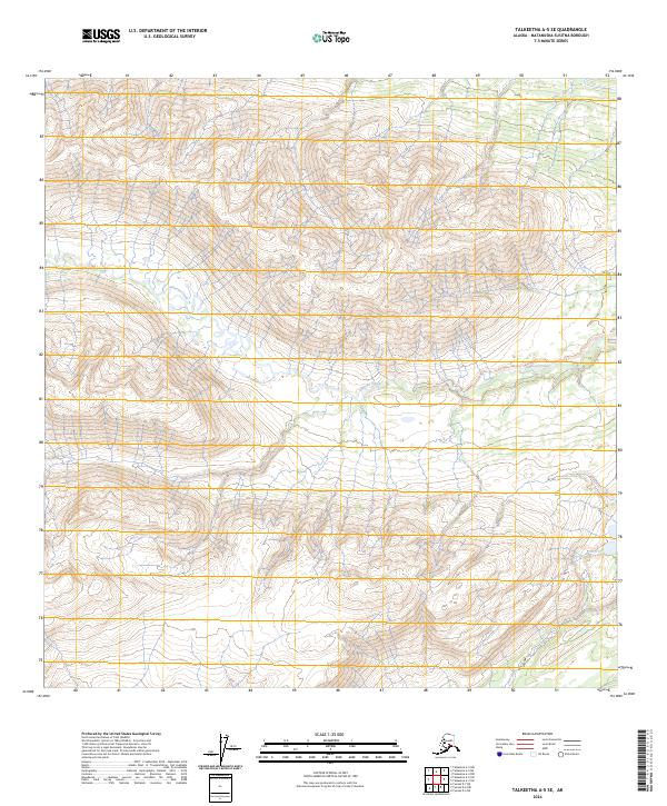
2024 Map of Talkeetna A-5 SE
USGS Topo · Published 2024About this map
High elevations and steep drainages dominate this portion of the Matanuska-Susitna Borough, where the terrain is primarily defined by the intricate path of Johnson Creek. Flowing through the central and eastern sections, the creek creates a primary axis for the local hydrology, while Red Creek appears in the southeastern corner near the lower township boundaries. The landscape is segmented by the Public Land Survey System grid, including t23n r16w and t23n r15w, which provide a structural framework for this roadless wilderness. Unlike many developed Alaskan regions, this area remains characterized by its natural watercourses and significant elevation changes rather than human settlements or infrastructure.
Find a feature on this map
8 named features on this map. Tap any name to fly to it.
Don’t see what you’re looking for? This feature index may not catch every label — zoom into the map to look around manually.
Map Details
Editions of this 2024 Talkeetna A-5 SE Map
This is the sole edition of this map. No revisions or reprints were ever made.
Other maps of this area

1949 · Tyonek
USGS Topo · 1:250,000

1950 · Talkeetna
USGS Topo · 1:250,000

1951 · Talkeetna
USGS Topo · 1:250,000

1951 · Tyonek
USGS Topo · 1:250,000

1954 · Talkeetna A-4
USGS Topo · 1:63,360

1958 · Tyonek D-6
USGS Topo · 1:63,360

1958 · Talkeetna A-5
USGS Topo · 1:63,360

1958 · Tyonek
USGS Topo · 1:250,000

1958 · Talkeetna
USGS Topo · 1:250,000
1958 · Tyonek D-7
USGS Topo · 1:63,360