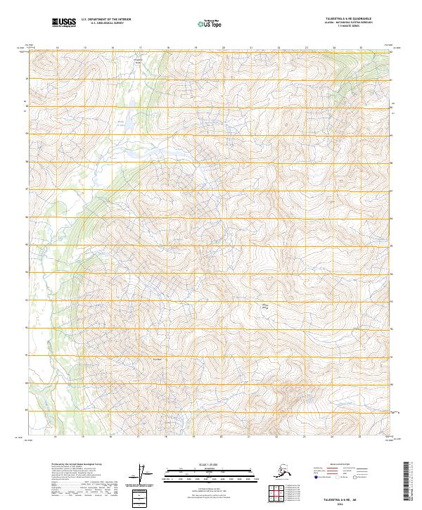
2024 Map of Talkeetna A-6 NE
USGS Topo · Published 2024About this map
Eva Peak and the high ridges of the Alaska Range define this high-elevation Alaskan landscape, where the headwaters of several major drainages begin their descent. This area, located within the Matanuska-Susitna Borough, remains a pristine wilderness environment centered on the steep slopes of Chuqitnu Tustes. The drainage patterns are clearly delineated, showing Moose Creek flowing south from Moose Cr Lake, while the Happy River and Glacier Creek cut through the southern townships.
Find a feature on this map
13 named features on this map. Tap any name to fly to it.
Don’t see what you’re looking for? This feature index may not catch every label — zoom into the map to look around manually.
Map Details
Editions of this 2024 Talkeetna A-6 NE Map
This is the sole edition of this map. No revisions or reprints were ever made.
Other maps of this area

1950 · Talkeetna
USGS Topo · 1:250,000

1951 · Talkeetna
USGS Topo · 1:250,000

1958 · Talkeetna A-6
USGS Topo · 1:63,360

1958 · Talkeetna A-5
USGS Topo · 1:63,360

1958 · Talkeetna B-5
USGS Topo · 1:63,360

1958 · Talkeetna B-6
USGS Topo · 1:63,360

1958 · Talkeetna
USGS Topo · 1:250,000

1965 · Talkeetna
USGS Topo · 1:250,000
2017 · Talkeetna A-6 SE
USGS Topo · 1:25,000
2017 · Talkeetna B-6 SW
USGS Topo · 1:25,000