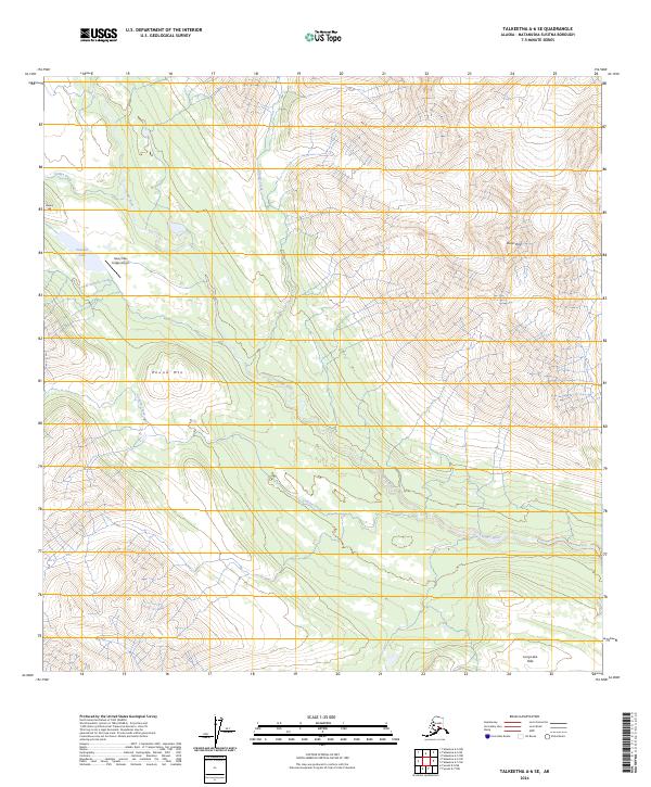
2024 Map of Talkeetna A-6 SE
USGS Topo · Published 2024About this map
Happy River and its major tributaries, including Canyon Creek and Glacier Creek, define the drainage patterns of this Matanuska-Susitna landscape. The terrain is characterized by prominent peaks and ridges, most notably Distin Peak and Round Mtn, which overlook the river valleys. A significant point of human access is the Rainy Pass Lodge Airport located on the shores of Puntilla Lake, serving as a critical node in a region where road networks are absent.
Find a feature on this map
17 named features on this map. Tap any name to fly to it.
Don’t see what you’re looking for? This feature index may not catch every label — zoom into the map to look around manually.
Map Details
Editions of this 2024 Talkeetna A-6 SE Map
This is the sole edition of this map. No revisions or reprints were ever made.
Other maps of this area

1949 · Tyonek
USGS Topo · 1:250,000

1950 · Talkeetna
USGS Topo · 1:250,000

1951 · Talkeetna
USGS Topo · 1:250,000

1951 · Tyonek
USGS Topo · 1:250,000

1958 · Talkeetna A-6
USGS Topo · 1:63,360

1958 · Talkeetna A-5
USGS Topo · 1:63,360

1958 · Tyonek D-8
USGS Topo · 1:63,360

1958 · Tyonek
USGS Topo · 1:250,000

1958 · Talkeetna
USGS Topo · 1:250,000
1958 · Tyonek D-7
USGS Topo · 1:63,360