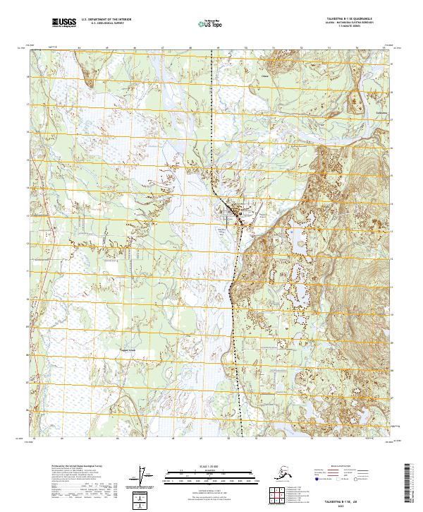
2023 Map of Talkeetna B-1 SE
USGS Topo · Published 2023About this map
The Susitna River and Chulitna River converge near Talkeetna, forming a complex braided waterway that dominates the central portion of this survey. This Alaskan river junction is a focal point for settlement and aviation, centered around the Talkeetna Village Strip and the Talkeetna Airport. Further west, the Trapper Creek settlement sits near the Parks Highway, while the smaller community of Chase lies to the north along the Chase Trail. Genealogists and local historians can find the Talkeetna Cem situated east of the main town site. The map captures a landscape shaped by seasonal water movement, marked by features like Billion Slough and Whiskey Slough. To the southeast, the terrain rises into the Bartlett Hills, contrasting with the expansive river flats that define the region's transport and utility corridors.
Find a feature on this map
69 named features on this map. Tap any name to fly to it.
Don’t see what you’re looking for? This feature index may not catch every label — zoom into the map to look around manually.
Map Details
Editions of this 2023 Talkeetna B-1 SE Map
This is the sole edition of this map. No revisions or reprints were ever made.
Other maps of this area

1949 · Talkeetna Mountains B-6
USGS Topo · 1:63,360

1950 · Talkeetna Mountains
USGS Topo · 1:250,000

1950 · Talkeetna
USGS Topo · 1:250,000

1950 · Talkeetna Mountains A-6
USGS Topo · 1:63,360

1951 · Talkeetna
USGS Topo · 1:250,000

1951 · Talkeetna B-1
USGS Topo · 1:63,360

1952 · Talkeetna Mountains B-6
USGS Topo · 1:63,360

1952 · Talkeetna A-1
USGS Topo · 1:63,360
1952 · Talkeetna Mountains A-6
USGS Topo · 1:63,360

1954 · Talkeetna Mountains
USGS Topo · 1:250,000