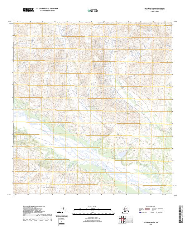
2024 Map of Talkeetna B-5 NE
USGS Topo · Published 2024About this map
The Denali National Preserve encompasses much of this area, where the high ridges of the Kichatna Mountains give way to a complex braided river system. The West Fork Yentna River dominates the southern landscape, winding through a broad glacial valley marked by shifting channels and seasonal wetlands. This drainage pattern highlights the dynamic nature of the Alaskan interior, as high-elevation meltwater from steep terrain flows toward the river's gravel bars and forested banks.
Find a feature on this map
10 named features on this map. Tap any name to fly to it.
Don’t see what you’re looking for? This feature index may not catch every label — zoom into the map to look around manually.
Map Details
Editions of this 2024 Talkeetna B-5 NE Map
This is the sole edition of this map. No revisions or reprints were ever made.
Other maps of this area

1950 · Talkeetna
USGS Topo · 1:250,000

1951 · Talkeetna
USGS Topo · 1:250,000

1954 · Talkeetna B-4
USGS Topo · 1:63,360

1958 · Talkeetna B-5
USGS Topo · 1:63,360

1958 · Talkeetna C-4
USGS Topo · 1:63,360

1958 · Talkeetna C-5
USGS Topo · 1:63,360

1958 · Talkeetna
USGS Topo · 1:250,000

1965 · Talkeetna
USGS Topo · 1:250,000
2017 · Talkeetna B-4 SW
USGS Topo · 1:25,000
2017 · Talkeetna B-4 NW
USGS Topo · 1:25,000