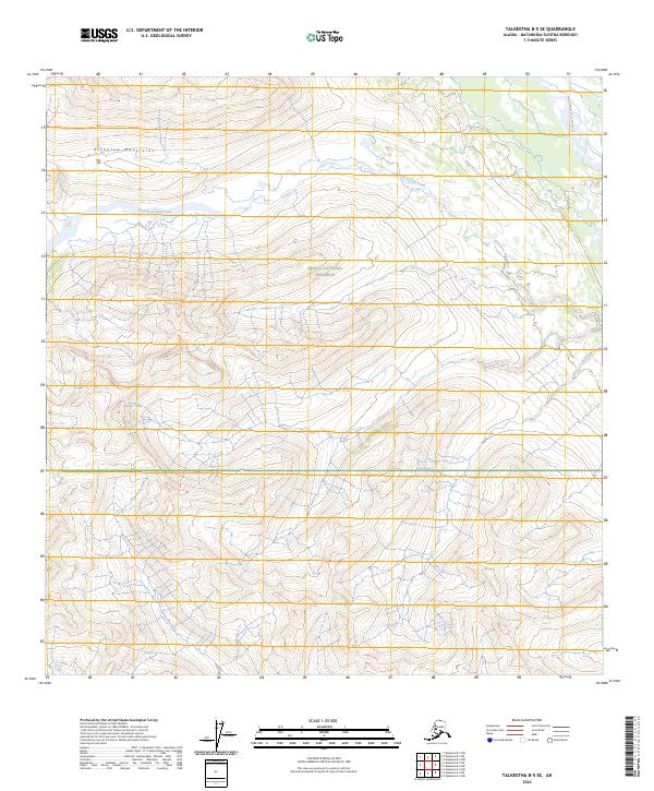
2024 Map of Talkeetna B-5 SE
USGS Topo · Published 2024About this map
The Kichatna Mountains define the high-elevation terrain of this Alaskan quadrangle, where the steep slopes of the Denali National Preserve meet an intricate network of glacial drainages. The landscape is dominated by the westward-flowing Fourth of July Creek, which carves through the central townships, and the Nakoehna River in the southwestern quadrant. This map offers a precise look at the uninhabited wilderness of the Matanuska-Susitna Borough, revealing how the drainage patterns of the West Fork Yentna River organize the lower elevations in the northeast. The absence of roads or permanent settlements underscores the isolation of these protected lands, where the natural topography remains the primary guide for navigation and land use study.
Find a feature on this map
9 named features on this map. Tap any name to fly to it.
Don’t see what you’re looking for? This feature index may not catch every label — zoom into the map to look around manually.
Map Details
Editions of this 2024 Talkeetna B-5 SE Map
This is the sole edition of this map. No revisions or reprints were ever made.
Other maps of this area

1950 · Talkeetna
USGS Topo · 1:250,000

1951 · Talkeetna
USGS Topo · 1:250,000

1954 · Talkeetna B-4
USGS Topo · 1:63,360

1954 · Talkeetna A-4
USGS Topo · 1:63,360

1958 · Talkeetna A-5
USGS Topo · 1:63,360

1958 · Talkeetna B-5
USGS Topo · 1:63,360

1958 · Talkeetna
USGS Topo · 1:250,000

1965 · Talkeetna
USGS Topo · 1:250,000
2017 · Talkeetna B-4 SW
USGS Topo · 1:25,000
2017 · Talkeetna A-4 NW
USGS Topo · 1:25,000