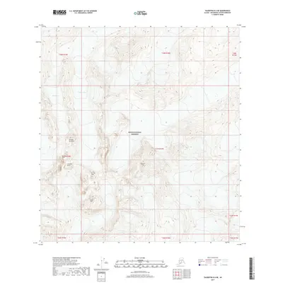
2017 Map of Talkeetna B-6 NE
USGS Topo · Published 2017About this map
The Kichatna Mountains define the high-altitude landscape of this area within the Denali National Preserve. This 2017 survey details a region dominated by dramatic vertical relief and permanent ice, including the jagged forms of the Cathedral Spires and the prominent Kichatna Spire. The topographic data reveals the glacial systems that have shaped these peaks, with the Shadows Glacier, Shelf Glacier, and Tatina Glacier carving deep into the mountain range.
Find a feature on this map
19 named features on this map. Tap any name to fly to it.
Don’t see what you’re looking for? This feature index may not catch every label — zoom into the map to look around manually.
Map Details
Editions of this 2017 Talkeetna B-6 NE Map
This is the sole edition of this map. No revisions or reprints were ever made.
Other maps of this area

1950 · Talkeetna
USGS Topo · 1:250,000

1951 · Talkeetna
USGS Topo · 1:250,000

1958 · Talkeetna B-5
USGS Topo · 1:63,360

1958 · Talkeetna B-6
USGS Topo · 1:63,360

1958 · Talkeetna C-6
USGS Topo · 1:63,360

1958 · Talkeetna C-5
USGS Topo · 1:63,360

1958 · Talkeetna
USGS Topo · 1:250,000

1965 · Talkeetna
USGS Topo · 1:250,000
2017 · Talkeetna C-6 SE
USGS Topo · 1:25,000
2017 · Talkeetna C-6 SW
USGS Topo · 1:25,000