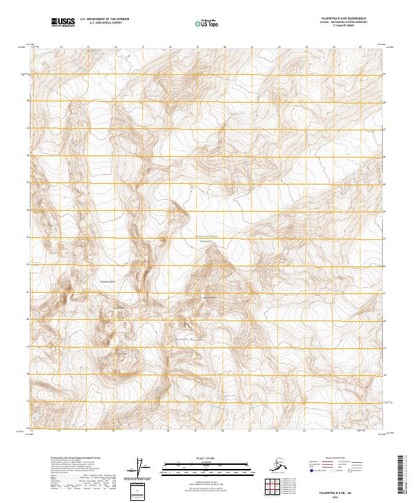
2024 Map of Talkeetna B-6 NE
USGS Topo · Published 2024About this map
Kichatna Mountains dominate this high-altitude terrain in the southwestern reach of Denali National Preserve. This landscape is defined by its verticality and glacial ice, where the dramatic granite peaks of the Cathedral Spires rise sharply above the moving ice of the Tatina Glacier and the Cul-de-sac Glacier. This area represents one of the more formidable mountain environments in the region, centered around prominent summits including Augustin Peak, Gurney Peak, and Lewis Peak. The map provides a detailed view of the complex drainage patterns and ice fields that have carved these remote valleys within the Matanuska-Susitna Borough, showing the land as it exists in the early 21st century.
Find a feature on this map
17 named features on this map. Tap any name to fly to it.
Don’t see what you’re looking for? This feature index may not catch every label — zoom into the map to look around manually.
Map Details
Editions of this 2024 Talkeetna B-6 NE Map
This is the sole edition of this map. No revisions or reprints were ever made.
Other maps of this area

1950 · Talkeetna
USGS Topo · 1:250,000

1951 · Talkeetna
USGS Topo · 1:250,000

1958 · Talkeetna B-5
USGS Topo · 1:63,360

1958 · Talkeetna B-6
USGS Topo · 1:63,360

1958 · Talkeetna C-6
USGS Topo · 1:63,360

1958 · Talkeetna C-5
USGS Topo · 1:63,360

1958 · Talkeetna
USGS Topo · 1:250,000

1965 · Talkeetna
USGS Topo · 1:250,000
2017 · Talkeetna C-6 SE
USGS Topo · 1:25,000
2017 · Talkeetna C-6 SW
USGS Topo · 1:25,000