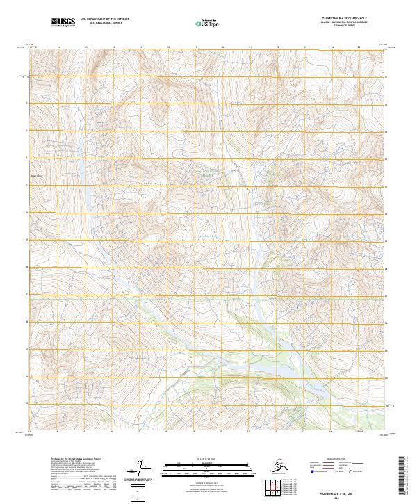
2024 Map of Talkeetna B-6 SE
USGS Topo · Published 2024About this map
Denali National Preserve encompasses a significant portion of this high-altitude landscape, where the Kichatna Mountains rise sharply as a subrange of the Alaska Range. The drainage patterns are defined by the Kichatna River, which flows through the southern and eastern reaches of the quadrangle, joined by the headwaters of Morris Creek. This 2024 survey illustrates a region largely defined by its natural topography rather than human infrastructure, as no roads or permanent settlements are recorded on the sheet. The terrain is structured by a grid of township and range boundaries, such as t26n r18w, which organize the remote territory for federal management and conservation purposes.
Find a feature on this map
11 named features on this map. Tap any name to fly to it.
Don’t see what you’re looking for? This feature index may not catch every label — zoom into the map to look around manually.
Map Details
Editions of this 2024 Talkeetna B-6 SE Map
This is the sole edition of this map. No revisions or reprints were ever made.
Other maps of this area

1950 · Talkeetna
USGS Topo · 1:250,000

1951 · Talkeetna
USGS Topo · 1:250,000

1958 · Talkeetna A-6
USGS Topo · 1:63,360

1958 · Talkeetna A-5
USGS Topo · 1:63,360

1958 · Talkeetna B-5
USGS Topo · 1:63,360

1958 · Talkeetna B-6
USGS Topo · 1:63,360

1958 · Talkeetna
USGS Topo · 1:250,000

1965 · Talkeetna
USGS Topo · 1:250,000
2017 · Talkeetna B-6 NW
USGS Topo · 1:25,000
2017 · Talkeetna B-6 SW
USGS Topo · 1:25,000