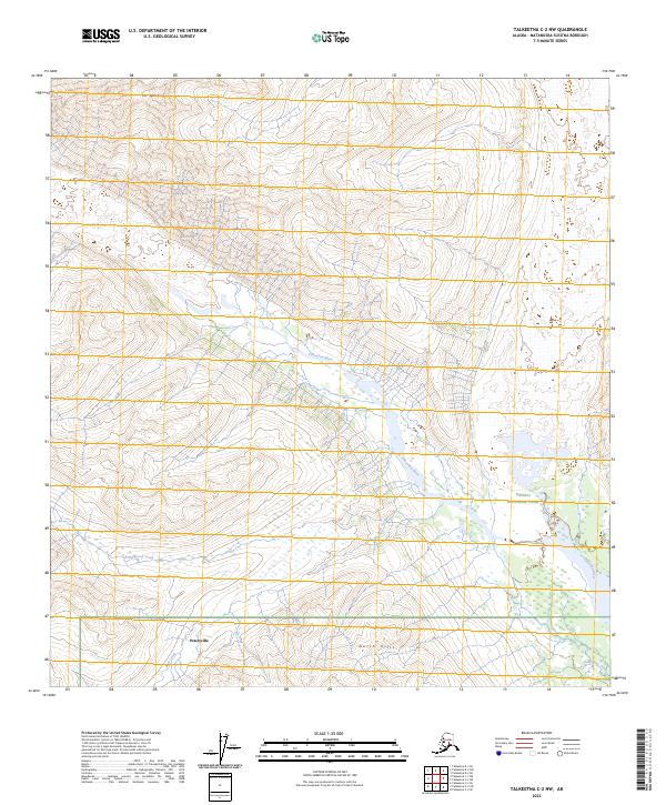
2023 Map of Talkeetna C-2 NW
USGS Topo · Published 2023About this map
Petersville marks the southern reach of this Matanuska-Susitna terrain, situated just below the rising elevations of the Dutch Hills. This landscape is defined by its glacial and riverine features, notably the Tokositna River which meanders through the central valley, and the high peak of Mt Goldie to the north. As the terrain moves eastward, it enters the protected boundary of Denali National Park, illustrating the transition from local settlement areas to managed wilderness. The intricate network of drainage is visible through features like Wildhorse Creek, Bear Creek, and Ramsdyke Creek, which carve through the foothills. The map provides a detailed view of the township and range survey lines, such as t30n r9w and t29n r9w, which underpin the land division in this region of Alaska.
Find a feature on this map
14 named features on this map. Tap any name to fly to it.
Don’t see what you’re looking for? This feature index may not catch every label — zoom into the map to look around manually.
Map Details
Editions of this 2023 Talkeetna C-2 NW Map
This is the sole edition of this map. No revisions or reprints were ever made.
Other maps of this area

1950 · Talkeetna
USGS Topo · 1:250,000

1951 · Talkeetna
USGS Topo · 1:250,000

1958 · Talkeetna C-2
USGS Topo · 1:63,360

1958 · Talkeetna D-2
USGS Topo · 1:63,360

1958 · Talkeetna C-3
USGS Topo · 1:63,360

1958 · Talkeetna D-3
USGS Topo · 1:63,360

1958 · Talkeetna
USGS Topo · 1:250,000

1965 · Talkeetna
USGS Topo · 1:250,000
2013 · Talkeetna C-2 SE
USGS Topo · 1:25,000
2014 · Talkeetna D-2 SW
USGS Topo · 1:25,000