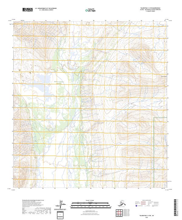
2023 Map of Talkeetna C-4 SW
USGS Topo · Published 2023About this map
Denali National Preserve encompasses a significant portion of this wilderness landscape, where the Alaska Range rises above the glacial drainage basins. The primary hydrological feature is the East Fork Yentna River, which meanders southward through a complex network of wetlands and braided channels. This 2023 survey illustrates the remote character of the Matanuska-Susitna region, showing a landscape defined by sharp elevation changes and the tributary waters of Loon Creek. The topographic detail emphasizes the isolation of the western preserve boundary, marked by the absence of road infrastructure and the dominance of natural landforms over human development. Researchers can examine the specific intersection of federal land management and the river systems that drain these northern highlands.
Find a feature on this map
10 named features on this map. Tap any name to fly to it.
Don’t see what you’re looking for? This feature index may not catch every label — zoom into the map to look around manually.
Map Details
Editions of this 2023 Talkeetna C-4 SW Map
This is the sole edition of this map. No revisions or reprints were ever made.
Other maps of this area

1950 · Talkeetna
USGS Topo · 1:250,000

1951 · Talkeetna
USGS Topo · 1:250,000

1954 · Talkeetna B-4
USGS Topo · 1:63,360

1958 · Talkeetna B-5
USGS Topo · 1:63,360

1958 · Talkeetna C-4
USGS Topo · 1:63,360

1958 · Talkeetna C-5
USGS Topo · 1:63,360

1958 · Talkeetna
USGS Topo · 1:250,000

1965 · Talkeetna
USGS Topo · 1:250,000
2014 · Talkeetna C-4 NW
USGS Topo · 1:25,000
2014 · Talkeetna C-4 NE
USGS Topo · 1:25,000