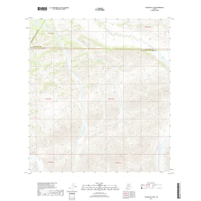
2017 Map of Talkeetna C-6 NW
USGS Topo · Published 2017About this map
Little Tonzona River flows through the heart of this Alaskan landscape, where the administrative boundaries of the Denali Borough, Matanuska-Susitna Borough, and the Yukon-Koyukuk Census Area converge. The terrain is defined by the complex drainage systems of the East Fork Little Tonzona River and Pingston Creek, showing the natural hydrology before any significant modern development. The map reveals a wild geography at the edge of three major Alaskan jurisdictions, highlighting the headwaters of the Big Salmon Fork and the intricate contours of the surrounding valleys. This 2017 survey serves as a precise record of the river channels and boundary lines in a region where the natural environment dictates the limits of human governance.
Find a feature on this map
15 named features on this map. Tap any name to fly to it.
Don’t see what you’re looking for? This feature index may not catch every label — zoom into the map to look around manually.
Map Details
Editions of this 2017 Talkeetna C-6 NW Map
This is the sole edition of this map. No revisions or reprints were ever made.
Other maps of this area

1949 · McGrath
USGS Topo · 1:250,000

1950 · McGrath
USGS Topo · 1:250,000

1950 · Talkeetna
USGS Topo · 1:250,000

1951 · Talkeetna
USGS Topo · 1:250,000

1958 · Talkeetna D-6
USGS Topo · 1:63,360

1958 · Talkeetna C-6
USGS Topo · 1:63,360

1958 · McGrath C-1
USGS Topo · 1:63,360

1958 · Talkeetna
USGS Topo · 1:250,000

1958 · McGrath D-1
USGS Topo · 1:63,360

1958 · McGrath
USGS Topo · 1:250,000