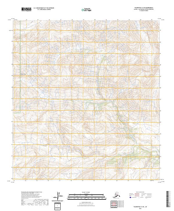
2024 Map of Talkeetna C-6 SE
USGS Topo · Published 2024About this map
The Denali National Preserve defines the central landscape of this wilderness survey, where the extreme topography of the Alaska Range meets the Kichatna Mountains in the south. This environment is shaped by the drainage of the West Fork Yentna River, which cuts a prominent valley through the high-elevation terrain. The map illustrates a remote section of the Matanuska-Susitna Borough where human infrastructure is entirely absent, replaced by complex contouring and glacial drainages. This cartographic study is primarily a record of natural hydrology and landform, documenting the protected boundaries of the preserve and the headwaters of the Yentna River system in its modern, undeveloped state.
Find a feature on this map
10 named features on this map. Tap any name to fly to it.
Don’t see what you’re looking for? This feature index may not catch every label — zoom into the map to look around manually.
Map Details
Editions of this 2024 Talkeetna C-6 SE Map
This is the sole edition of this map. No revisions or reprints were ever made.
Other maps of this area

1950 · Talkeetna
USGS Topo · 1:250,000

1951 · Talkeetna
USGS Topo · 1:250,000

1958 · Talkeetna B-5
USGS Topo · 1:63,360

1958 · Talkeetna B-6
USGS Topo · 1:63,360

1958 · Talkeetna C-6
USGS Topo · 1:63,360

1958 · Talkeetna C-5
USGS Topo · 1:63,360

1958 · Talkeetna
USGS Topo · 1:250,000

1965 · Talkeetna
USGS Topo · 1:250,000
2017 · Talkeetna C-6 SE
USGS Topo · 1:25,000
2017 · Talkeetna C-6 SW
USGS Topo · 1:25,000