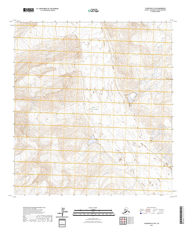
2023 Map of Talkeetna D-2 SW
USGS Topo · Published 2023About this map
The high-altitude terrain of the Alaska Range dominates this quadrangle, illustrating the dramatic verticality of the northern interior. Much of the western and central portions of the sheet fall within the protected boundaries of Denali National Park, preserving a landscape characterized by steep glacial cirques, sharp ridges, and high peaks. The absence of roads or human settlements reflects the wilderness character of the region. Instead, the map focuses on physical geography and the complex hydrography of alpine streams. Precise township and range lines, such as the boundary between t32n r9w and t32n r8w, provide the only administrative grid over this undeveloped expanse of the Matanuska-Susitna Borough.
Find a feature on this map
6 named features on this map. Tap any name to fly to it.
Don’t see what you’re looking for? This feature index may not catch every label — zoom into the map to look around manually.
Map Details
Editions of this 2023 Talkeetna D-2 SW Map
This is the sole edition of this map. No revisions or reprints were ever made.
Other maps of this area

1950 · Talkeetna
USGS Topo · 1:250,000

1951 · Talkeetna
USGS Topo · 1:250,000

1958 · Talkeetna C-2
USGS Topo · 1:63,360

1958 · Talkeetna D-2
USGS Topo · 1:63,360

1958 · Talkeetna C-3
USGS Topo · 1:63,360

1958 · Talkeetna D-3
USGS Topo · 1:63,360

1958 · Talkeetna
USGS Topo · 1:250,000

1965 · Talkeetna
USGS Topo · 1:250,000
2014 · Talkeetna D-2 SW
USGS Topo · 1:25,000
2014 · Talkeetna C-2 NW
USGS Topo · 1:25,000