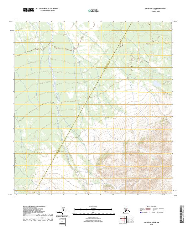
2024 Map of Talkeetna D-6 SW
USGS Topo · Published 2024About this map
Pingston Creek meanders through the central corridor of this interior Alaskan landscape, marking a remote boundary line between the Yukon-Koyukuk Census Area and the Denali Borough. This survey captures a transitional wilderness where the valley floor, characterized by the winding waters of Clear Fork, meets the rising elevations of the southern interior. The map illustrates the administrative division of this roadless territory as it stood in 2024, providing a precise look at the township and range lines across sections of T31N and T32N. The topography transitions from broad riparian zones in the west to steep, ridged terrain in the southeast, documenting the natural drainage patterns that define this uninhabited stretch of the Alaskan wilderness.
Find a feature on this map
7 named features on this map. Tap any name to fly to it.
Don’t see what you’re looking for? This feature index may not catch every label — zoom into the map to look around manually.
Map Details
Editions of this 2024 Talkeetna D-6 SW Map
This is the sole edition of this map. No revisions or reprints were ever made.
Other maps of this area

1949 · McGrath
USGS Topo · 1:250,000

1950 · McGrath
USGS Topo · 1:250,000

1950 · Talkeetna
USGS Topo · 1:250,000

1951 · Talkeetna
USGS Topo · 1:250,000

1958 · Talkeetna D-6
USGS Topo · 1:63,360

1958 · Talkeetna C-6
USGS Topo · 1:63,360

1958 · McGrath C-1
USGS Topo · 1:63,360

1958 · Talkeetna
USGS Topo · 1:250,000

1958 · McGrath D-1
USGS Topo · 1:63,360

1958 · McGrath
USGS Topo · 1:250,000