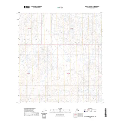
2023 Map of Talkeetna Mountains A-3 NW
USGS Topo · Published 2023About this map
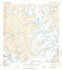
Talkeetna Glacier feeds the high-elevation drainage systems of the Matanuska-Susitna region, anchoring a landscape defined by glacial melt and alpine hydrology. The Talkeetna River winds through the northwestern portion of this 2023 survey, while the headwaters of the Chickaloon River emerge in the southeast. These waterways, including the northern reach of Clear Creek, follow the natural contours of the mountain range within the Public Land Survey System grids of t25n r5e and t24n r6e. The lack of road infrastructure or established settlements emphasizes the primitive state of this terrain, where modern satellite imagery and elevation datasets are used to track the slow movement of ice and the shifting paths of river braids in one of Alaska’s most formidable wilderness areas.
Find a feature on this map
9 named features on this map. Tap any name to fly to it.
Don’t see what you’re looking for? This feature index may not catch every label — zoom into the map to look around manually.
Map Details
Editions of this 2023 Talkeetna Mountains A-3 NW Map
This is the sole edition of this map. No revisions or reprints were ever made.
Other maps of this area

1949 · Talkeetna Mountains A-4
USGS Topo · 1:63,360

1950 · Talkeetna Mountains
USGS Topo · 1:250,000

1950 · Talkeetna Mountains B-4
USGS Topo · 1:63,360

1951 · Talkeetna Mountains B-3
USGS Topo · 1:63,360

1951 · Talkeetna Mountains A-3
USGS Topo · 1:63,360
1952 · Talkeetna Mountains B-4
USGS Topo · 1:63,360
1952 · Talkeetna Mountains B-3
USGS Topo · 1:63,360
1952 · Talkeetna Mountains A-3
USGS Topo · 1:63,360
1954 · Talkeetna Mountains A-4
USGS Topo · 1:63,360

1954 · Talkeetna Mountains
USGS Topo · 1:250,000