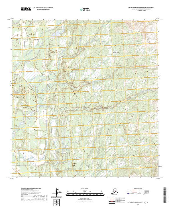
2023 Map of Talkeetna Mountains A-6 NW
USGS Topo · Published 2023About this map
Susitna North serves as the primary residential anchor in this region of the Matanuska-Susitna Borough, where a network of local roads fans out into the surrounding wetlands and woodlands. The landscape is defined by the intricate drainage systems of Montana Creek and its major tributaries, including the North Fork Montana Creek, Middle Fork Montana Creek, and South Fork Montana Creek. These waterways, along with Buddy Creek and Answer Creek, weave through a terrain marked by numerous small ponds and marshy depressions typical of the Alaskan interior.
Find a feature on this map
34 named features on this map. Tap any name to fly to it.
Don’t see what you’re looking for? This feature index may not catch every label — zoom into the map to look around manually.
Map Details
Editions of this 2023 Talkeetna Mountains A-6 NW Map
This is the sole edition of this map. No revisions or reprints were ever made.
Other maps of this area

1949 · Talkeetna Mountains B-6
USGS Topo · 1:63,360

1950 · Talkeetna Mountains
USGS Topo · 1:250,000

1950 · Talkeetna
USGS Topo · 1:250,000

1950 · Talkeetna Mountains A-6
USGS Topo · 1:63,360

1951 · Talkeetna
USGS Topo · 1:250,000

1951 · Talkeetna B-1
USGS Topo · 1:63,360

1952 · Talkeetna Mountains B-6
USGS Topo · 1:63,360

1952 · Talkeetna A-1
USGS Topo · 1:63,360
1952 · Talkeetna Mountains A-6
USGS Topo · 1:63,360

1954 · Talkeetna Mountains
USGS Topo · 1:250,000