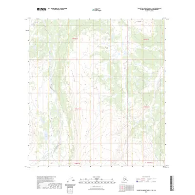
2023 Map of Talkeetna Mountains B-1 NW
USGS Topo · Published 2023About this map
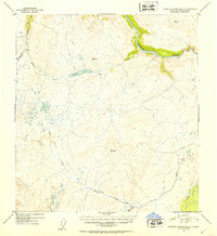
Big Bones Ridge dominates the central portion of this Matanuska-Susitna interior, part of a high-altitude drainage network that defines the Talkeetna Mountains. The landscape is characterized by its significant river systems, including the Oshetna River and the Black River, which flow through sections of the T28N and T27N townships. Elevations reach their peak at landmarks like Lone Butte in the northeast, while the southeastern corner is carved by the winding course of Sanona Creek. The absence of developed roads or settlements emphasizes the remote nature of this wilderness at the time of the 2023 survey. This quadrangle serves as an essential record of the glacial and hydraulic features of the Alaskan interior, showing the specific boundaries of the t27n r11e and t28n r12e survey blocks.
Find a feature on this map
11 named features on this map. Tap any name to fly to it.
Don’t see what you’re looking for? This feature index may not catch every label — zoom into the map to look around manually.
Map Details
Editions of this 2023 Talkeetna Mountains B-1 NW Map
This is the sole edition of this map. No revisions or reprints were ever made.
Other maps of this area

1950 · Talkeetna Mountains
USGS Topo · 1:250,000

1951 · Talkeetna Mountains B-1
USGS Topo · 1:63,360

1951 · Talkeetna Mountains C-2
USGS Topo · 1:63,360

1951 · Talkeetna Mountains B-2
USGS Topo · 1:63,360

1951 · Talkeetna Mountains C-1
USGS Topo · 1:63,360
1952 · Talkeetna Mountains C-1
USGS Topo · 1:63,360
1952 · Talkeetna Mountains B-2
USGS Topo · 1:63,360
1952 · Talkeetna Mountains B-1
USGS Topo · 1:63,360
1952 · Talkeetna Mountains C-2
USGS Topo · 1:63,360

1954 · Talkeetna Mountains
USGS Topo · 1:250,000