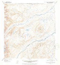
1952 Map of Talkeetna Mountains B-2
USGS Topo · Published 1953About this map
The Talkeetna Mountains define this high-altitude landscape in the Matanuska-Susitna region, as documented in this mid-century topographic survey. The area is dominated by the complex drainage systems of the Oshetna River and the Black River, which carve through the elevations alongside smaller tributaries like Granite Creek and Gold Creek. A notable landmark is Twin Hills, standing between the river valleys, while Black Lake provides a rare still-water feature among the numerous streams. The topography, derived from 1949 aerial photography, captures the drainage patterns before any significant human development, showing a land defined entirely by its natural watercourses and glacial features.
Find a feature on this map
11 named features on this map. Tap any name to fly to it.
Don’t see what you’re looking for? This feature index may not catch every label — zoom into the map to look around manually.
Map Details
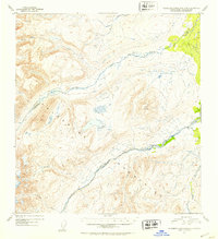
Editions of this 1952 Talkeetna Mountains B-2 Map
2 editions found
Other maps of this area

1949 · Talkeetna Mountains A-1
USGS Topo · 1:63,360

1950 · Talkeetna Mountains
USGS Topo · 1:250,000

1951 · Talkeetna Mountains B-1
USGS Topo · 1:63,360

1951 · Talkeetna Mountains A-2
USGS Topo · 1:63,360

1951 · Talkeetna Mountains C-2
USGS Topo · 1:63,360

1951 · Talkeetna Mountains B-3
USGS Topo · 1:63,360

1951 · Talkeetna Mountains A-3
USGS Topo · 1:63,360

1951 · Talkeetna Mountains B-2
USGS Topo · 1:63,360

1951 · Talkeetna Mountains C-1
USGS Topo · 1:63,360

1951 · Talkeetna Mountains C-3
USGS Topo · 1:63,360