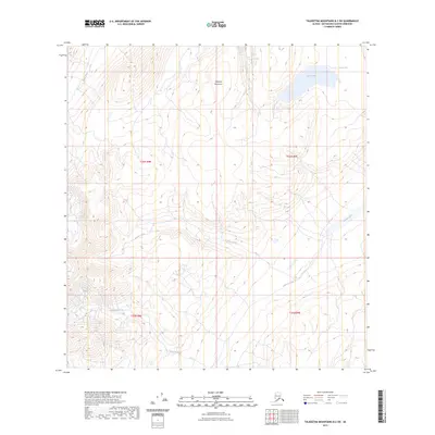
2023 Map of Talkeetna Mountains B-2 SW
USGS Topo · Published 2023About this map
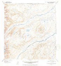
The Talkeetna Mountains define this high-altitude landscape in the Matanuska-Susitna Borough, where glacial and alpine hydrology creates a complex network of drainage basins. The area is anchored by Crater Lake in the northeast, while the Oshetna River and Black River navigate the high country. Several smaller waterways, including Granite Creek and Roaring Creek, cut through the terrain, illustrating the natural erosion patterns of the subarctic environment. This 2023 survey serves as a vital record of the untouched wilderness within the Public Land Survey System, showing the townships of t26n r8e, t26n r9e, t25n r8e, and t25n r9e. The absence of roads or permanent structures emphasizes the region's character as a remote corridor for natural water systems and seasonal change.
Find a feature on this map
10 named features on this map. Tap any name to fly to it.
Don’t see what you’re looking for? This feature index may not catch every label — zoom into the map to look around manually.
Map Details
Editions of this 2023 Talkeetna Mountains B-2 SW Map
This is the sole edition of this map. No revisions or reprints were ever made.
Other maps of this area

1950 · Talkeetna Mountains
USGS Topo · 1:250,000

1951 · Talkeetna Mountains A-2
USGS Topo · 1:63,360

1951 · Talkeetna Mountains B-3
USGS Topo · 1:63,360

1951 · Talkeetna Mountains A-3
USGS Topo · 1:63,360

1951 · Talkeetna Mountains B-2
USGS Topo · 1:63,360
1952 · Talkeetna Mountains A-2
USGS Topo · 1:63,360
1952 · Talkeetna Mountains B-3
USGS Topo · 1:63,360
1952 · Talkeetna Mountains A-3
USGS Topo · 1:63,360
1952 · Talkeetna Mountains B-2
USGS Topo · 1:63,360

1954 · Talkeetna Mountains
USGS Topo · 1:250,000