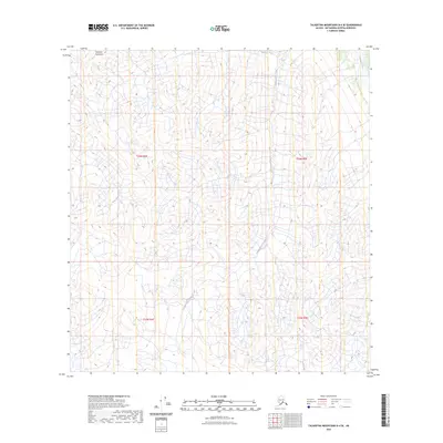
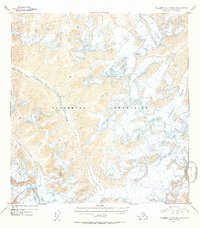
2023 Map of Talkeetna Mountains B-4 SE
USGS Topo · Published 2023About this map
The Talkeetna Mountains define this high-elevation terrain in the Matanuska-Susitna region, where complex drainage patterns shape the landscape. The Talkeetna River flows through the northeastern corner, fed by a network of steep-descending waterways including Yellowjacket Creek and the East Fork Iron Creek. This map captures a strictly natural environment, lacking roads or settlements, and emphasizing the hydrological and topographical structure of the Alaskan interior. The reliance on remote sensing and imagery from 2010 provides a modern baseline for this remote area, which is organized by the Public Land Survey System into townships like t26n r4e and t26n r5e. The absence of human-made infrastructure highlights the area's character as a raw mountain wilderness defined by its seasonal runoff and elevation changes.
Find a feature on this map
8 named features on this map. Tap any name to fly to it.
Don’t see what you’re looking for? This feature index may not catch every label — zoom into the map to look around manually.
Map Details
Editions of this 2023 Talkeetna Mountains B-4 SE Map
This is the sole edition of this map. No revisions or reprints were ever made.
Other maps of this area

1949 · Talkeetna Mountains A-4
USGS Topo · 1:63,360

1950 · Talkeetna Mountains
USGS Topo · 1:250,000

1950 · Talkeetna Mountains B-4
USGS Topo · 1:63,360

1951 · Talkeetna Mountains B-3
USGS Topo · 1:63,360

1951 · Talkeetna Mountains A-3
USGS Topo · 1:63,360
1952 · Talkeetna Mountains B-4
USGS Topo · 1:63,360
1952 · Talkeetna Mountains B-3
USGS Topo · 1:63,360
1952 · Talkeetna Mountains A-3
USGS Topo · 1:63,360
1954 · Talkeetna Mountains A-4
USGS Topo · 1:63,360

1954 · Talkeetna Mountains
USGS Topo · 1:250,000