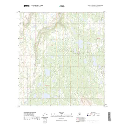
2023 Map of Talkeetna Mountains C-1 SW
USGS Topo · Published 2023About this map
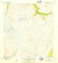
Oshetna River carves through this portion of the Talkeetna Mountains, defining a landscape of complex drainage systems and shifting river channels. The river is joined by the Black River in the northern reaches, while Goose Creek flows across the western edge of the quadrangle. This 2023 survey by the U.S. Geological Survey illustrates the intricate hydrography of the Matanuska-Susitna region, where wide valley floors are broken by isolated topographical features like Lone Butte. The map serves as a contemporary record of these waterways before they transition through the high-elevation terrain of the interior. Public Land Survey System boundaries, including t29n r11e and t28n r12e, provide a structured grid over a territory largely defined by its natural watercourses and elevation contours.
Find a feature on this map
9 named features on this map. Tap any name to fly to it.
Don’t see what you’re looking for? This feature index may not catch every label — zoom into the map to look around manually.
Map Details
Editions of this 2023 Talkeetna Mountains C-1 SW Map
This is the sole edition of this map. No revisions or reprints were ever made.
Other maps of this area

1950 · Talkeetna Mountains
USGS Topo · 1:250,000

1951 · Talkeetna Mountains B-1
USGS Topo · 1:63,360

1951 · Talkeetna Mountains C-2
USGS Topo · 1:63,360

1951 · Talkeetna Mountains B-2
USGS Topo · 1:63,360

1951 · Talkeetna Mountains C-1
USGS Topo · 1:63,360
1952 · Talkeetna Mountains C-1
USGS Topo · 1:63,360
1952 · Talkeetna Mountains B-2
USGS Topo · 1:63,360
1952 · Talkeetna Mountains B-1
USGS Topo · 1:63,360
1952 · Talkeetna Mountains C-2
USGS Topo · 1:63,360

1954 · Talkeetna Mountains
USGS Topo · 1:250,000