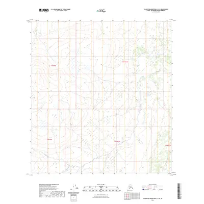
2023 Map of Talkeetna Mountains C-2 SE
USGS Topo · Published 2023About this map
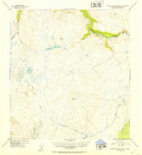
Goose Creek flows through this high-altitude landscape in the Talkeetna Mountains, where the drainage patterns suggest a complex glacial geography. The upper reaches of the creek are flanked by steep contour gradients, transitioning into broader basins as the water moves south through the township markers of t29n r10e and t28n r10e. In the southern portion of the sheet, the terrain accommodates Busch Creek, which meanders through a lower valley floor before its junction with the larger drainage systems outside this area. The absence of roads or established settlements on this survey emphasizes the remote character of this part of the Matanuska-Susitna Borough, highlighting a landscape defined almost entirely by its natural hydrology and township-range boundaries.
Find a feature on this map
7 named features on this map. Tap any name to fly to it.
Don’t see what you’re looking for? This feature index may not catch every label — zoom into the map to look around manually.
Map Details
Editions of this 2023 Talkeetna Mountains C-2 SE Map
This is the sole edition of this map. No revisions or reprints were ever made.
Other maps of this area

1950 · Talkeetna Mountains
USGS Topo · 1:250,000

1951 · Talkeetna Mountains B-1
USGS Topo · 1:63,360

1951 · Talkeetna Mountains C-2
USGS Topo · 1:63,360

1951 · Talkeetna Mountains B-2
USGS Topo · 1:63,360

1951 · Talkeetna Mountains C-1
USGS Topo · 1:63,360
1952 · Talkeetna Mountains C-1
USGS Topo · 1:63,360
1952 · Talkeetna Mountains B-2
USGS Topo · 1:63,360
1952 · Talkeetna Mountains B-1
USGS Topo · 1:63,360
1952 · Talkeetna Mountains C-2
USGS Topo · 1:63,360

1954 · Talkeetna Mountains
USGS Topo · 1:250,000