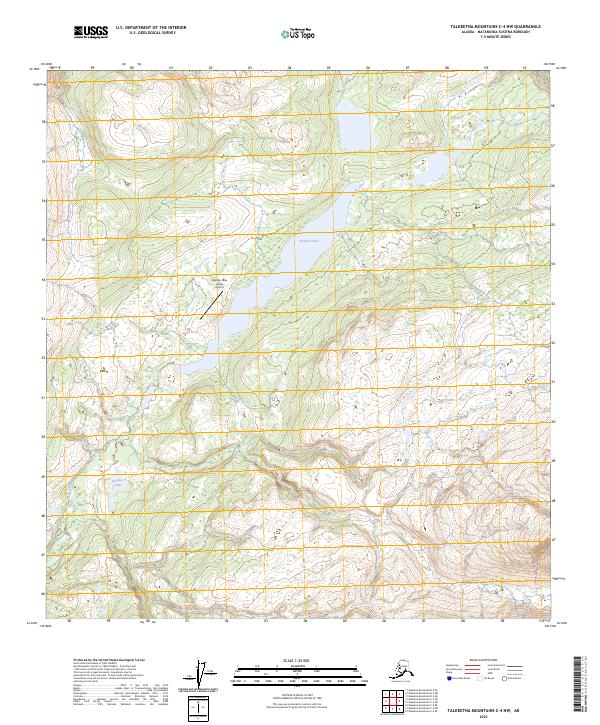
2023 Map of Talkeetna Mountains C-4 NW
USGS Topo · Published 2023About this map
Stephan Lake dominates this high-latitude terrain, serving as a focal point for aviation and recreation in the Alaskan interior. The presence of the Stephan Lake Lodge Airport on the lake's western shore highlights the region's reliance on bush planes for access, a characteristic of remote Matanuska-Susitna landscapes where roads are absent. To the south, Daneka Lake and the meandering course of Prairie Creek indicate a complex drainage system within the Talkeetna Mountains. The landscape is structured by the Public Land Survey System, with township boundaries such as t31n r3e and t30n r3e providing a grid over the otherwise trackless terrain. This map captures a slice of the Alaska wilderness defined by its water bodies and the specialized infrastructure required to reach them.
Find a feature on this map
13 named features on this map. Tap any name to fly to it.
Don’t see what you’re looking for? This feature index may not catch every label — zoom into the map to look around manually.
Map Details
Editions of this 2023 Talkeetna Mountains C-4 NW Map
This is the sole edition of this map. No revisions or reprints were ever made.
Other maps of this area

1950 · Talkeetna Mountains
USGS Topo · 1:250,000

1950 · Talkeetna Mountains D-5
USGS Topo · 1:63,360

1950 · Talkeetna Mountains C-5
USGS Topo · 1:63,360

1951 · Talkeetna Mountains D-5
USGS Topo · 1:63,360

1951 · Talkeetna Mountains C-4
USGS Topo · 1:63,360

1951 · Talkeetna Mountains D-4
USGS Topo · 1:63,360
1952 · Talkeetna Mountains C-5
USGS Topo · 1:63,360
1952 · Talkeetna Mountains D-4
USGS Topo · 1:63,360
1952 · Talkeetna Mountains C-4
USGS Topo · 1:63,360

1954 · Talkeetna Mountains
USGS Topo · 1:250,000