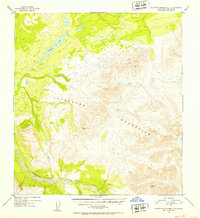
1952 Map of Talkeetna Mountains C-4
USGS Topo · Published 1953About this map
Stephan Lake and its surrounding drainage systems dominate the northwest corner of this mid-century survey, which documents a high-altitude wilderness during the early 1950s. The landscape is defined by the massive southern reaches of the Talkeetna Mountains, where elevation data is carefully noted at triangulation stations such as VABM 5850 Grebe and VABM 6218 Jims. Human presence is minimal, marked only by a solitary Cabin situated along the shores of the lake, suggesting a remote outpost for trapping, hunting, or early geological exploration. Along the southern edge of the quadrangle, the braided channels of the Talkeetna River cut through the terrain, fed by the waters of Prairie Creek. This survey serves as a precise record of the drainage patterns and peaks in a region largely untouched by permanent settlement or infrastructure at the time of mapping.
Find a feature on this map
7 named features on this map. Tap any name to fly to it.
Don’t see what you’re looking for? This feature index may not catch every label — zoom into the map to look around manually.
Map Details
Editions of this 1952 Talkeetna Mountains C-4 Map
2 editions found
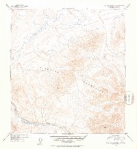
Other maps of this area

1950 · Talkeetna Mountains
USGS Topo · 1:250,000

1950 · Talkeetna Mountains B-5
USGS Topo · 1:63,360

1950 · Talkeetna Mountains B-4
USGS Topo · 1:63,360

1950 · Talkeetna Mountains D-5
USGS Topo · 1:63,360

1950 · Talkeetna Mountains C-5
USGS Topo · 1:63,360

1951 · Talkeetna Mountains D-5
USGS Topo · 1:63,360

1951 · Talkeetna Mountains B-3
USGS Topo · 1:63,360

1951 · Talkeetna Mountains C-4
USGS Topo · 1:63,360

1951 · Talkeetna Mountains D-3
USGS Topo · 1:63,360

1951 · Talkeetna Mountains D-4
USGS Topo · 1:63,360