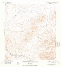
1952 Map of Talkeetna Mountains C-4
USGS Topo · Published 1953About this map
Stephan Lake sits at the northern edge of this high-elevation landscape, where the waters of Prairie Creek begin their descent through the Talkeetna Mountains. This 1952 topographic study, based on 1949 aerial photography, captures a wilderness area defined by sharp relief and glacial drainage patterns. To the south, the Talkeetna River flows along the base of several peaks, including the surveyed high points at Vabm 6218 Guiana and Vabm 5850 Grebe. Evidence of human presence is minimal in this sector of the Alaska Range, marked only by a solitary Cabin near the western shore of the lake. The contour lines reveal a complex network of unnamed ridges and valleys that feed into the major waterways, illustrating the untouched nature of the Alaskan interior during the early 1950s.
Find a feature on this map
7 named features on this map. Tap any name to fly to it.
Don’t see what you’re looking for? This feature index may not catch every label — zoom into the map to look around manually.
Map Details
Editions of this 1952 Talkeetna Mountains C-4 Map
2 editions found
Other maps of this area

1950 · Talkeetna Mountains
USGS Topo · 1:250,000

1950 · Talkeetna Mountains B-5
USGS Topo · 1:63,360

1950 · Talkeetna Mountains B-4
USGS Topo · 1:63,360

1950 · Talkeetna Mountains D-5
USGS Topo · 1:63,360

1950 · Talkeetna Mountains C-5
USGS Topo · 1:63,360

1951 · Talkeetna Mountains D-5
USGS Topo · 1:63,360

1951 · Talkeetna Mountains B-3
USGS Topo · 1:63,360

1951 · Talkeetna Mountains C-4
USGS Topo · 1:63,360

1951 · Talkeetna Mountains D-3
USGS Topo · 1:63,360

1951 · Talkeetna Mountains D-4
USGS Topo · 1:63,360