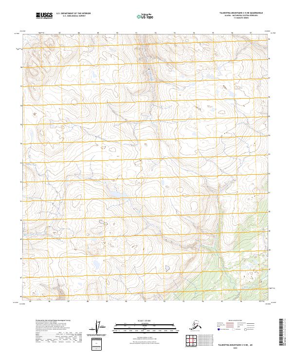
2023 Map of Talkeetna Mountains C-5 NE
USGS Topo · Published 2023About this map
Chinook Creek and Chunilna Creek dominate this upper-altitude landscape within the Matanuska-Susitna Borough, where narrow watercourses carve through high terrain defined by the Public Land Survey System boundaries of t31n r2e and t30n r1e. The drainage patterns shown here provide a detailed view of the headwaters that feed into the larger Susitna River basin. The absence of roads or established settlements on this sheet reflects the wilderness character of the region, emphasizing the primary topographical and hydrological features such as Prairie Creek in the southeastern corner. This survey is essential for understanding the remote watersheds of the Talkeetna Mountains during the early twenty-first century.
Find a feature on this map
9 named features on this map. Tap any name to fly to it.
Don’t see what you’re looking for? This feature index may not catch every label — zoom into the map to look around manually.
Map Details
Editions of this 2023 Talkeetna Mountains C-5 NE Map
This is the sole edition of this map. No revisions or reprints were ever made.
Other maps of this area

1950 · Talkeetna Mountains
USGS Topo · 1:250,000

1950 · Talkeetna Mountains D-5
USGS Topo · 1:63,360

1950 · Talkeetna Mountains C-5
USGS Topo · 1:63,360

1951 · Talkeetna Mountains D-5
USGS Topo · 1:63,360

1951 · Talkeetna Mountains C-4
USGS Topo · 1:63,360

1951 · Talkeetna Mountains D-4
USGS Topo · 1:63,360
1952 · Talkeetna Mountains C-5
USGS Topo · 1:63,360
1952 · Talkeetna Mountains D-4
USGS Topo · 1:63,360
1952 · Talkeetna Mountains C-4
USGS Topo · 1:63,360

1954 · Talkeetna Mountains
USGS Topo · 1:250,000