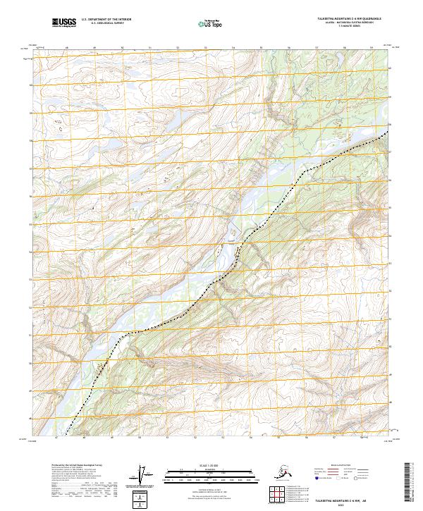
2023 Map of Talkeetna Mountains C-6 NW
USGS Topo · Published 2023About this map
The Susitna Valley landscape dominates this modern 2023 survey, centered on the powerful braided channel of the Susitna River. This specific reach of the river reflects the vast, undeveloped character of the Matanuska-Susitna Borough, where the waterway serves as the primary corridor through the valley floor. To the west, the elevation rises sharply toward Curry Ridge, providing a topographical boundary that funnels glacial runoff into the basin. The drainage of Troublesome Creek cuts through the northwestern portion of the map, illustrating the complex hydrology of the region's tributary systems. This 2023 edition provides an precise look at the contemporary contours and glacial silt-fed riverbeds of the Alaskan interior before any significant modern settlement or road infrastructure has altered the natural river plain.
Find a feature on this map
10 named features on this map. Tap any name to fly to it.
Don’t see what you’re looking for? This feature index may not catch every label — zoom into the map to look around manually.
Map Details
Editions of this 2023 Talkeetna Mountains C-6 NW Map
This is the sole edition of this map. No revisions or reprints were ever made.
Other maps of this area

1949 · Talkeetna Mountains D-6
USGS Topo · 1:63,360

1949 · Talkeetna Mountains C-6
USGS Topo · 1:63,360

1950 · Talkeetna Mountains
USGS Topo · 1:250,000

1950 · Talkeetna
USGS Topo · 1:250,000

1951 · Talkeetna
USGS Topo · 1:250,000

1951 · Talkeetna C-1
USGS Topo · 1:63,360

1951 · Talkeetna Mountains D-6
USGS Topo · 1:63,360

1952 · Talkeetna Mountains C-6
USGS Topo · 1:63,360

1952 · Talkeetna Mountains D-6
USGS Topo · 1:63,360

1954 · Talkeetna Mountains
USGS Topo · 1:250,000