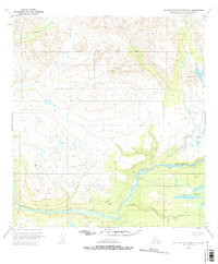
1951 Map of Talkeetna Mountains D-4
USGS Topo · Published 1975About this map
The Susitna River carves a massive path through the southern portion of this interior Alaskan landscape, serving as the dominant hydrological feature before it flows southwest toward the Cook Inlet. In the early 1950s, this area remained largely untouched by permanent settlement, defined instead by the complex drainage patterns of major tributaries like Portage Creek and Devil Creek to the north.
Find a feature on this map
9 named features on this map. Tap any name to fly to it.
Don’t see what you’re looking for? This feature index may not catch every label — zoom into the map to look around manually.
Map Details
Editions of this 1951 Talkeetna Mountains D-4 Map
3 editions found

Other maps of this area

1950 · Talkeetna Mountains
USGS Topo · 1:250,000

1950 · Talkeetna Mountains D-5
USGS Topo · 1:63,360

1950 · Healy A-3
USGS Topo · 1:63,360

1950 · Healy A-4
USGS Topo · 1:63,360

1950 · Healy A-5
USGS Topo · 1:63,360

1950 · Talkeetna Mountains C-5
USGS Topo · 1:63,360

1951 · Healy
USGS Topo · 1:250,000

1951 · Talkeetna Mountains D-5
USGS Topo · 1:63,360

1951 · Talkeetna Mountains C-4
USGS Topo · 1:63,360

1951 · Talkeetna Mountains D-3
USGS Topo · 1:63,360