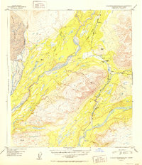
1952 Map of Talkeetna Mountains D-6
USGS Topo · Published 1952About this map
The Alaska Railroad serves as the primary artery through this mountainous corridor, following the narrow drainage of the Indian River and the Gold Creek valley. In the early 1950s, small railway-adjacent settlements like Hurricane, Chulitna, and Gold Creek provided essential footholds in the wilderness, many consisting of little more than a station house or a Cabin. The landscape is dominated by the confluence of major glacial-fed waters, where the Chulitna River and Susitna River carve through the terrain beneath the massive Eldridge Glacier.
Find a feature on this map
29 named features on this map. Tap any name to fly to it.
Don’t see what you’re looking for? This feature index may not catch every label — zoom into the map to look around manually.
Map Details
Editions of this 1952 Talkeetna Mountains D-6 Map
2 editions found

Other maps of this area

1949 · Talkeetna Mountains D-6
USGS Topo · 1:63,360

1949 · Talkeetna Mountains C-6
USGS Topo · 1:63,360

1949 · Healy A-6
USGS Topo · 1:63,360

1950 · Talkeetna Mountains
USGS Topo · 1:250,000

1950 · Talkeetna
USGS Topo · 1:250,000

1950 · Talkeetna Mountains D-5
USGS Topo · 1:63,360

1950 · Healy A-5
USGS Topo · 1:63,360

1950 · Talkeetna Mountains C-5
USGS Topo · 1:63,360

1951 · Talkeetna
USGS Topo · 1:250,000

1951 · Healy
USGS Topo · 1:250,000