
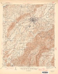
1946 Map of Talladega
USGS Topo · Published 1946About this map
Talladega serves as the bustling center of this 1940s landscape, where the Southern Railway and Louisville and Nashville Railroad converge to facilitate the regional economy. Industrial and community hubs like Bemiston and the County Training School sit near the city, while the surrounding countryside is defined by small agricultural settlements and centers of trade such as Sycamore and Winterboro. Along the winding course of Talladega Creek, evidence of local industry appears at Allison Mills and Reynolds Mill, marking where water power was once harnessed for production.
Find a feature on this map
78 named features on this map. Tap any name to fly to it.
Don’t see what you’re looking for? This feature index may not catch every label — zoom into the map to look around manually.
Map Details
Editions of this 1946 Talladega Map
2 editions found
Other maps of this area

1889 · Springville
USGS Topo · 1:125,000

1890 · Talladega
USGS Topo · 1:125,000

1891 · Ashland
USGS Topo · 1:125,000

1892 · Springville
USGS Topo · 1:125,000

1892 · Talladega
USGS Topo · 1:125,000

1900 · Anniston
USGS Topo · 1:125,000

1915 · Gantts Quarry
USGS Topo · 1:48,000

1917 · Gantts Quarry
USGS Topo · 1:62,500

1943 · Talladega
USGS Topo · 1:62,500

1944 · Goodwater
USGS Topo · 1:62,500