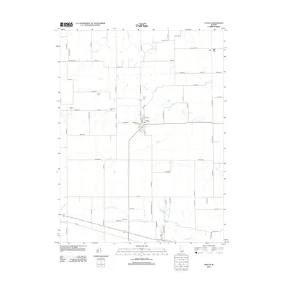
2012 Map of Tallula
USGS Topo · Published 2012About this map
Tallula serves as the central hub of this Central Illinois landscape, where the town grid meets a network of section-line roads and family-named routes. The terrain is defined by the drainage of Clary Cr and N Fork Richland Cr, winding through a predominantly agricultural area along the Sangamon Menard Co Rd. Genealogists and local historians will find significant value in the distribution of rural burial sites, including Bethel Cem, Greenwood Cem, White Cem, Smedly Cem, and Willson Cem, many of which sit near the edges of original farmstead tracts. Notable landmarks such as Hill Top and Braun Pond break the steady rhythm of the fields, while roads like Neinberger Rd and Schonewis Rd reflect the heritage of the families who settled this portion of the Illinois prairie.
Find a feature on this map
82 named features on this map. Tap any name to fly to it.
Don’t see what you’re looking for? This feature index may not catch every label — zoom into the map to look around manually.
Map Details
Editions of this 2012 Tallula Map
This is the sole edition of this map. No revisions or reprints were ever made.
Other maps of this area

1909 · Tallula
USGS Topo · 1:62,500

1930 · Chandlerville
USGS Topo · 1:62,500

1932 · Chandlerville
USGS Topo · 1:62,500

1932 · Virginia
USGS Topo · 1:62,500

1933 · Petersburg
USGS Topo · 1:62,500

1936 · Virginia
USGS Topo · 1:62,500

1938 · Petersburg
USGS Topo · 1:62,500

1940 · Tallula
USGS Topo · 1:62,500

1948 · Quincy
USGS Topo · 1:250,000

1956 · Quincy
USGS Topo · 1:250,000