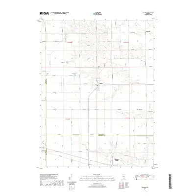
2018 Map of Tallula
USGS Topo · Published 2018About this map
Tallula and Pleasant Plains anchor this agricultural landscape at the meeting of Cass, Menard, and Sangamon counties. The terrain is defined by the branching drainages of Clary Cr and Richland Cr, which carve through the prairie to create localized relief. For genealogists, the map preserves the locations of several small burial grounds, including Smedly Cem, White Cem, and Willson Cem, often situated near property lines or the edges of drainage basins like Cuttingson Cr. A grid of country roads, such as Ed Hinrichs Rd and Markert Ave, connects these rural hubs and family-named landmarks like Hill Top. The map's layout highlights the transition between the established towns and the sprawling farmland that defines the Central Illinois corridor between Ashland and the surrounding townships.
Find a feature on this map
87 named features on this map. Tap any name to fly to it.
Don’t see what you’re looking for? This feature index may not catch every label — zoom into the map to look around manually.
Map Details
Editions of this 2018 Tallula Map
This is the sole edition of this map. No revisions or reprints were ever made.
Other maps of this area

1909 · Tallula
USGS Topo · 1:62,500

1930 · Chandlerville
USGS Topo · 1:62,500

1932 · Chandlerville
USGS Topo · 1:62,500

1932 · Virginia
USGS Topo · 1:62,500

1933 · Petersburg
USGS Topo · 1:62,500

1936 · Virginia
USGS Topo · 1:62,500

1938 · Petersburg
USGS Topo · 1:62,500

1940 · Tallula
USGS Topo · 1:62,500

1948 · Quincy
USGS Topo · 1:250,000

1956 · Quincy
USGS Topo · 1:250,000