
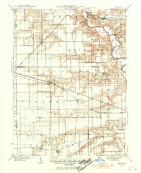
1940 Map of Tallula
USGS Topo · Published 1956About this map
New Salem State Park preserves the frontier history of the Sangamon River valley, anchoring this 1940 culture revision of Central Illinois. The map documents a landscape defined by its vital rail corridors, including the Chicago and Alton RR and the Baltimore and Southwestern RR, which supported agricultural settlements like Tallula and Pleasant Plains. Along the eastern boundary, the Old Salem Chautauqua sits on the bluffs above the river, a remnant of the early 20th-century educational and social movement.
Find a feature on this map
31 named features on this map. Tap any name to fly to it.
Don’t see what you’re looking for? This feature index may not catch every label — zoom into the map to look around manually.
Map Details
Editions of this 1940 Tallula Map
2 editions found
Other maps of this area

1907 · Springfield
USGS Topo · 1:62,500

1909 · Tallula
USGS Topo · 1:62,500

1922 · Divernon
USGS Topo · 1:62,500

1924 · Divernon
USGS Topo · 1:62,500

1924 · Waverly
USGS Topo · 1:62,500

1926 · Waverly
USGS Topo · 1:62,500

1930 · Chandlerville
USGS Topo · 1:62,500

1930 · Springfield
USGS Topo · 1:62,500

1932 · Chandlerville
USGS Topo · 1:62,500

1932 · Jacksonville
USGS Topo · 1:62,500