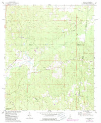
1974 Map of Tamola
USGS Topo · Published 1987About this map
Tamola sits at the heart of this East Mississippi landscape, where the state line meets the junction of Lauderdale, Kemper, and Sumter counties. The terrain is defined by a dense network of waterways, including the Sucarnoochee River and the curiously named Roasted Hog Creek, alongside smaller tributaries like Ponta Creek. Local life is anchored by numerous rural congregations and burial grounds, such as Mt Hebron Ch, Center Ridge Ch, and the Lauderdale Springs Cem.
Find a feature on this map
33 named features on this map. Tap any name to fly to it.
Don’t see what you’re looking for? This feature index may not catch every label — zoom into the map to look around manually.
Map Details
Editions of this 1974 Tamola Map
2 editions found
Other maps of this area

1921 · Meridian
USGS Topo · 1:48,000

1923 · Meridian
USGS Topo · 1:62,500

1953 · Meridian
USGS Topo · 1:250,000

1957 · Meridian
USGS Topo · 1:250,000

1962 · Lauderdale
USGS Topo · 1:24,000

1962 · Oak Grove
USGS Topo · 1:24,000

1965 · Meridian
USGS Topo · 1:250,000
1971 · Toomsuba
USGS Topo · 1:24,000

1974 · Boyd
USGS Topo · 1:24,000
1974 · Tamola
USGS Topo · 1:24,000