
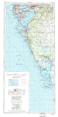
1956 Map of Tampa
USGS Topo · Published 1964About this map
The Florida Gulf Coast from Tampa south to Sanibel Island appears here during a period of significant mid-century expansion. While the urban centers of St Petersburg and Sarasota show dense development, the interior reaches of the Myakka River and Peace River reveal a landscape still defined by agriculture and native terrain. The prominence of Mac Dill AFB on the peninsula between Old Tampa Bay and Hillsborough Bay underscores the region's strategic military importance.
Find a feature on this map
183 named features on this map. Tap any name to fly to it.
Don’t see what you’re looking for? This feature index may not catch every label — zoom into the map to look around manually.
Map Details
Editions of this 1956 Tampa Map
2 editions found
Other maps of this area

1921 · Sand Key
USGS Topo · 1:62,500

1921 · Tampa
USGS Topo · 1:62,500

1921 · Fort De Soto
USGS Topo · 1:62,500

1921 · St Petersburg
USGS Topo · 1:62,500

1942 · Cockroach Bay
USGS Topo · 1:31,680

1943 · St Petersburg
USGS Topo · 1:31,680

1943 · Gandy Bridge
USGS Topo · 1:31,680

1943 · Pass-A-Grille
USGS Topo · 1:31,680

1943 · Bay Pines
USGS Topo · 1:31,680

1943 · Safety Harbor
USGS Topo · 1:31,680