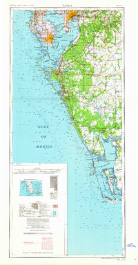
1960 Map of Tampa
USGS Topo · Published 1960About this map
Tampa and St Petersburg anchor this mid-century coastal survey, reflecting a period of significant post-war expansion along the Gulf Coast. The landscape is defined by its complex shoreline, from the urbanization surrounding Tampa Bay and Old Tampa Bay to the developing barrier islands like Anna Maria Key and Longboat Key. Significant infrastructure is present, including the massive footprint of Mac Dill Afb and the industrial rail networks of the Atlantic Coast Line RR and the Seaboard Air Line RR which connected these growing ports to the interior.
Find a feature on this map
50 named features on this map. Tap any name to fly to it.
Don’t see what you’re looking for? This feature index may not catch every label — zoom into the map to look around manually.
Map Details
Editions of this 1960 Tampa Map
2 editions found

Other maps of this area

1921 · Sand Key
USGS Topo · 1:62,500

1921 · Tampa
USGS Topo · 1:62,500

1921 · Fort De Soto
USGS Topo · 1:62,500

1921 · St Petersburg
USGS Topo · 1:62,500

1942 · Cockroach Bay
USGS Topo · 1:31,680

1943 · St Petersburg
USGS Topo · 1:31,680

1943 · Gandy Bridge
USGS Topo · 1:31,680

1943 · Pass-A-Grille
USGS Topo · 1:31,680

1943 · Bay Pines
USGS Topo · 1:31,680

1943 · Safety Harbor
USGS Topo · 1:31,680