
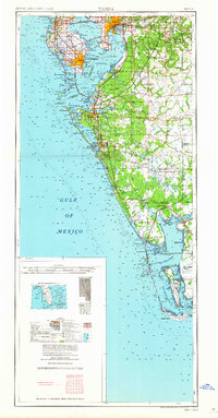
1960 Map of Tampa
USGS Topo · Published 1960About this map
Tampa and St Petersburg serve as the urban anchors of this mid-century Gulf Coast landscape, connected by the engineering feats of the Courtney Campbell Causeway and the Sunshine Skyway. The map captures a period of significant post-war expansion along the Florida coast, where the strategic military presence at Mac Dill AFB sits adjacent to growing residential communities like Pinellas Park and Largo. Beyond the urban centers, the southern coastline transitions into a network of barrier islands including Sanibel Island and Captiva Island, while the inland regions are defined by the Myakka River State Park. Industrial and transit corridors are clearly marked by the competing routes of the Atlantic Coast Line and the Seaboard Air Line railroads, which facilitated the movement of goods and people during this era of rapid development.
Find a feature on this map
47 named features on this map. Tap any name to fly to it.
Don’t see what you’re looking for? This feature index may not catch every label — zoom into the map to look around manually.
Map Details
Editions of this 1960 Tampa Map
2 editions found
Other maps of this area

1921 · Sand Key
USGS Topo · 1:62,500

1921 · Tampa
USGS Topo · 1:62,500

1921 · Fort De Soto
USGS Topo · 1:62,500

1921 · St Petersburg
USGS Topo · 1:62,500

1942 · Cockroach Bay
USGS Topo · 1:31,680

1943 · St Petersburg
USGS Topo · 1:31,680

1943 · Gandy Bridge
USGS Topo · 1:31,680

1943 · Pass-A-Grille
USGS Topo · 1:31,680

1943 · Bay Pines
USGS Topo · 1:31,680

1943 · Safety Harbor
USGS Topo · 1:31,680