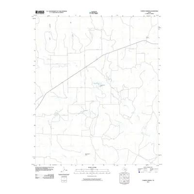
2010 Map of Tampico Siding
USGS Topo · Published 2010About this map
Tampico Siding anchors this Hall County landscape, situated near the intersection of the railway and FM 657. This high plains region is defined by a dendritic network of ephemeral watercourses and draws that carve through the Texas panhandle. Significant local water management is evident at Chamberlain Lake, secured by Chamberlain Dam, and further south at Lane Dam along the drainage of Cottonwood Creek.
Find a feature on this map
22 named features on this map. Tap any name to fly to it.
Don’t see what you’re looking for? This feature index may not catch every label — zoom into the map to look around manually.
Map Details
Editions of this 2010 Tampico Siding Map
This is the sole edition of this map. No revisions or reprints were ever made.
Other maps of this area

1954 · Plainview
USGS Topo · 1:250,000

1958 · Plainview
USGS Topo · 1:250,000

1960 · Brice
USGS Topo · 1:62,500

1961 · Memphis
USGS Topo · 1:62,500

1967 · North Windmill
USGS Topo · 1:24,000

1967 · Cottonwood Camp
USGS Topo · 1:24,000

1967 · Tampico Siding
USGS Topo · 1:24,000

1967 · Turkey
USGS Topo · 1:24,000

1967 · Blue Tank Canyon
USGS Topo · 1:24,000
1967 · Folley
USGS Topo · 1:24,000