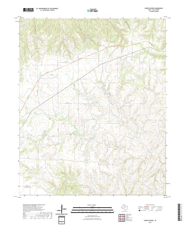
2022 Map of Tampico Siding
USGS Topo · Published 2022About this map
Wolf Flat sits at the southern edge of this West Texas landscape, where the flat plains of Hall County begin to drop into a complex network of draws and canyons. The terrain is defined by dramatic erosional features like Hill Canyon, Mullin Canyon, and the deeply etched Oxbow Trap Canyon in the north. These rugged breaks carry water toward the Wind River and Cottonwood Cr, creating a broken topography that historically challenged travel and ranching.
Find a feature on this map
29 named features on this map. Tap any name to fly to it.
Don’t see what you’re looking for? This feature index may not catch every label — zoom into the map to look around manually.
Map Details
Editions of this 2022 Tampico Siding Map
This is the sole edition of this map. No revisions or reprints were ever made.
Other maps of this area

1954 · Plainview
USGS Topo · 1:250,000

1958 · Plainview
USGS Topo · 1:250,000

1960 · Brice
USGS Topo · 1:62,500

1961 · Memphis
USGS Topo · 1:62,500

1967 · North Windmill
USGS Topo · 1:24,000

1967 · Cottonwood Camp
USGS Topo · 1:24,000

1967 · Tampico Siding
USGS Topo · 1:24,000

1967 · Turkey
USGS Topo · 1:24,000

1967 · Blue Tank Canyon
USGS Topo · 1:24,000
1967 · Folley
USGS Topo · 1:24,000