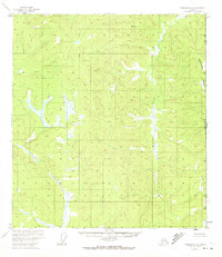
1952 Map of Tanacross A-1
USGS Topo · Published 1972About this map
The Alaska Yukon border defines the eastern edge of this 1952 topographic study, where the high terrain of Moosehorn Ridge overlooks a series of valley wetlands. The landscape is dominated by the complex drainage patterns of Gardiner Creek and McArthur Creek, which wind through a remote expanse marked by high-altitude survey markers like Flat VABM 3385 and Bump VABM 2947. This 1:63,360 scale map, based on aerial photography from the early 1950s, records a vast interior wilderness before significant modern infrastructure. The absence of roads or established settlements reflects the traditional character of the Southeast Fairbanks region during the mid-century era, providing a precise record of the natural hydrology and topographical relief along the United States Canada international boundary.
Find a feature on this map
7 named features on this map. Tap any name to fly to it.
Don’t see what you’re looking for? This feature index may not catch every label — zoom into the map to look around manually.
Map Details
Editions of this 1952 Tanacross A-1 Map
2 editions found
Other maps of this area

1949 · Tanacross
USGS Topo · 1:250,000

1950 · Tanacross
USGS Topo · 1:250,000

1950 · Nabesna
USGS Topo · 1:250,000

1951 · Nabesna
USGS Topo · 1:250,000

1952 · Nabesna D-1
USGS Topo · 1:63,360

1952 · Tanacross A-1
USGS Topo · 1:63,360

1954 · Tanacross A-2
USGS Topo · 1:63,360

1954 · Nabesna D-2
USGS Topo · 1:63,360

1955 · Tanacross A-2
USGS Topo · 1:63,360

1955 · Nabesna D-2
USGS Topo · 1:63,360