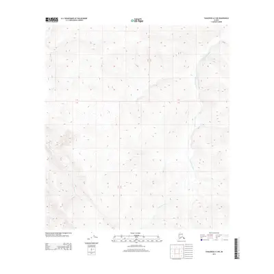
2013 Map of Tanacross A-2 NW
USGS Topo · Published 2013About this map
S Fork Ladue River meanders through the eastern portion of this 2013 survey, carving a deep valley through the interior highlands of the Unorganized Borough. This wilderness area, characterized by its complex drainages and lack of road infrastructure, is further defined by the headwaters of Bitters Cr in the southwest. The map provides a high-resolution look at the natural hydrology of the Tanacross region before modern development, focusing on the topographic relief between the R 18 E and R 19 E range lines. The landscape is entirely undeveloped, with the USGS identifying only the primary watercourses and the established township and range grid system.
Find a feature on this map
4 named features on this map. Tap any name to fly to it.
Don’t see what you’re looking for? This feature index may not catch every label — zoom into the map to look around manually.
Map Details
Editions of this 2013 Tanacross A-2 NW Map
This is the sole edition of this map. No revisions or reprints were ever made.
Other maps of this area

1948 · Tanacross A-3
USGS Topo · 1:63,360

1948 · Tanacross B-3
USGS Topo · 1:63,360

1949 · Tanacross
USGS Topo · 1:250,000

1949 · Tanacross B-3
USGS Topo · 1:63,360

1950 · Tanacross
USGS Topo · 1:250,000

1952 · Tanacross A-3
USGS Topo · 1:63,360

1952 · Tanacross B-3
USGS Topo · 1:63,360

1954 · Tanacross A-2
USGS Topo · 1:63,360

1955 · Tanacross A-2
USGS Topo · 1:63,360
1956 · Tanacross B-2
USGS Topo · 1:63,360