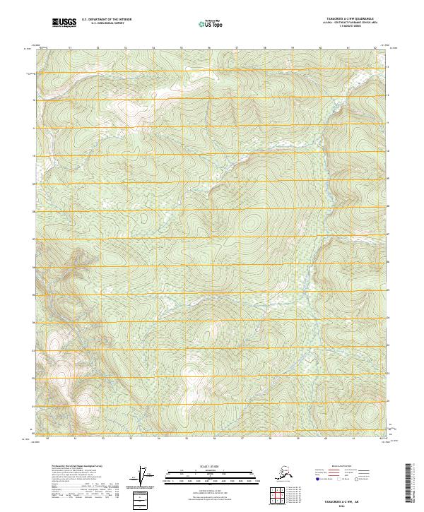
2024 Map of Tanacross A-2 NW
USGS Topo · Published 2024About this map
The South Fork Ladue River meanders through the eastern section of this landscape, serving as the primary drainage for the surrounding highlands in the Southeast Fairbanks Census Area. This remote terrain is defined by its complex network of stream valleys and elevated ridges, including the drainage of Bitters Creek in the northwest. The map detail reflects the vast, undeveloped nature of the Alaska interior, where the Public Land Survey System grids such as T17n R18e and T16n R19e provide the only human-imposed structure on an otherwise wild topography. Researchers can examine the intricate contour patterns that illustrate the high-latitude drainage systems and wetland areas typical of the upper Ladue River basin.
Find a feature on this map
6 named features on this map. Tap any name to fly to it.
Don’t see what you’re looking for? This feature index may not catch every label — zoom into the map to look around manually.
Map Details
Editions of this 2024 Tanacross A-2 NW Map
This is the sole edition of this map. No revisions or reprints were ever made.
Other maps of this area

1948 · Tanacross A-3
USGS Topo · 1:63,360

1948 · Tanacross B-3
USGS Topo · 1:63,360

1949 · Tanacross
USGS Topo · 1:250,000

1949 · Tanacross B-3
USGS Topo · 1:63,360

1950 · Tanacross
USGS Topo · 1:250,000

1952 · Tanacross A-3
USGS Topo · 1:63,360

1952 · Tanacross B-3
USGS Topo · 1:63,360

1954 · Tanacross A-2
USGS Topo · 1:63,360

1955 · Tanacross A-2
USGS Topo · 1:63,360
1956 · Tanacross B-2
USGS Topo · 1:63,360