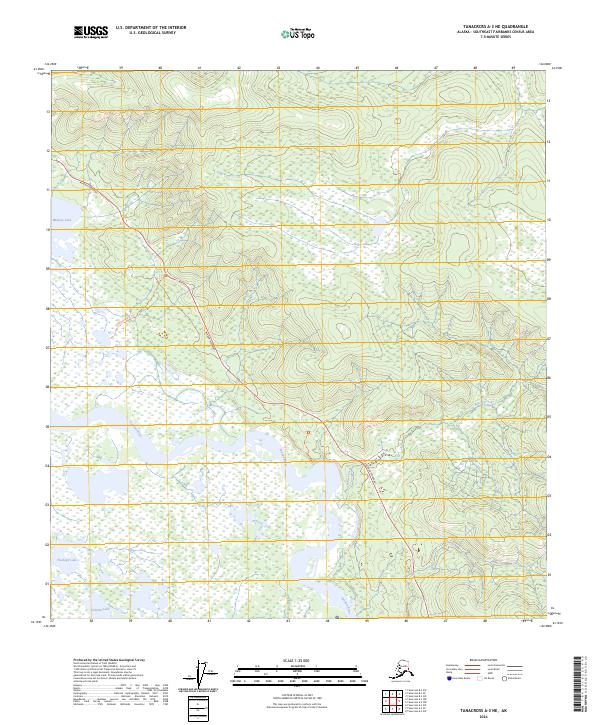
2024 Map of Tanacross A-3 NE
USGS Topo · Published 2024About this map
The Tanana River cuts through this portion of the Southeast Fairbanks Census Area, creating a complex wetland environment dominated by the Tetlin National Wildlife Refuge. This landscape is defined by its vast water bodies, including the prominent Midway Lake to the north and the smaller Tlechegn Lake and Tsilchin Lake situated in the southern marshes. The Alaska Highway provides the primary corridor for movement, skirting the base of higher elevations to the northeast before crossing the lower river plains. The terrain transitions from the upland drainage of Bitters Creek to the saturated lowlands of the refuge. Access into the more remote interior is noted by the 17b5 Easement Trl, which offers a rare overland route through the dense network of lake basins and river bends characteristic of the Alaskan interior.
Find a feature on this map
13 named features on this map. Tap any name to fly to it.
Don’t see what you’re looking for? This feature index may not catch every label — zoom into the map to look around manually.
Map Details
Editions of this 2024 Tanacross A-3 NE Map
This is the sole edition of this map. No revisions or reprints were ever made.
Other maps of this area

1948 · Tanacross A-3
USGS Topo · 1:63,360

1948 · Tanacross B-3
USGS Topo · 1:63,360

1949 · Tanacross
USGS Topo · 1:250,000

1949 · Tanacross B-3
USGS Topo · 1:63,360

1950 · Tanacross
USGS Topo · 1:250,000

1952 · Tanacross A-3
USGS Topo · 1:63,360

1952 · Tanacross B-3
USGS Topo · 1:63,360

1954 · Tanacross A-2
USGS Topo · 1:63,360

1955 · Tanacross A-2
USGS Topo · 1:63,360
1956 · Tanacross B-2
USGS Topo · 1:63,360