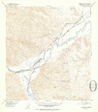
1952 Map of Tanacross A-5
USGS Topo · Published 1952About this map
The Tok River and Little Tok River dominate this interior Alaskan landscape, which at mid-century was defined by early aviation and the establishment of highway corridors. Much of the southern and eastern territory is occupied by the Tetlin Indian Reservation, while the historic Eagle Trail cuts a diagonal path across the drainage. Small, functional outposts like Eagle Inn, Log Cabin Inn, and the already noted Clearwater Camp (Aban'd) served travelers along these routes. The presence of the Mineral Point Landing Field near the river confluence highlights the era's reliance on bush pilots and small aircraft for access. Topographic details are meticulously recorded with several triangulation stations, including VABM 5975 Meikle and VABM 5085 Natohona, marking the high peaks between the Clearwater Creek and Shindata Creek drainages.
Find a feature on this map
48 named features on this map. Tap any name to fly to it.
Don’t see what you’re looking for? This feature index may not catch every label — zoom into the map to look around manually.
Map Details
Editions of this 1952 Tanacross A-5 Map
2 editions found
Other maps of this area

1948 · Tanacross B-5
USGS Topo · 1:63,360

1948 · Tanacross A-6
USGS Topo · 1:63,360

1948 · Tanacross A-4
USGS Topo · 1:63,360

1948 · Nabesna D-5
USGS Topo · 1:63,360

1948 · Tanacross A-5
USGS Topo · 1:63,360

1949 · Tanacross
USGS Topo · 1:250,000

1949 · Tanacross B-4
USGS Topo · 1:63,360

1949 · Nabesna D-6
USGS Topo · 1:63,360

1949 · Tanacross A-5
USGS Topo · 1:63,360

1949 · Tanacross B-6
USGS Topo · 1:63,360