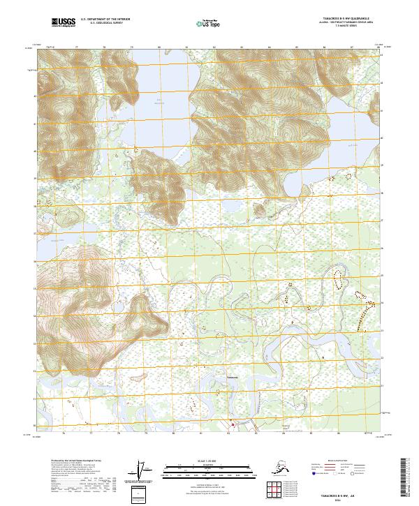
2024 Map of Tanacross B-5 NW
USGS Topo · Published 2024About this map
The Tanacross settlement sits along the northern bank of the winding Tanana River, serving as a focal point for this Interior Alaska landscape. The topography transitions from the river's complex system of sloughs, including the Little Tanana Slough, toward the higher elevations of the north. Significant water bodies like Lake Mansfield and Fish Lake are connected by a network of drainage systems such as Mansfield Creek and Little Fish Creek, illustrating the area's intricate hydrology.
Find a feature on this map
16 named features on this map. Tap any name to fly to it.
Don’t see what you’re looking for? This feature index may not catch every label — zoom into the map to look around manually.
Map Details
Editions of this 2024 Tanacross B-5 NW Map
This is the sole edition of this map. No revisions or reprints were ever made.
Other maps of this area

1948 · Tanacross B-5
USGS Topo · 1:63,360

1949 · Tanacross
USGS Topo · 1:250,000

1949 · Tanacross B-6
USGS Topo · 1:63,360

1950 · Tanacross
USGS Topo · 1:250,000

1951 · Tanacross B-6
USGS Topo · 1:63,360

1952 · Tanacross B-5
USGS Topo · 1:63,360

1954 · Tanacross C-6
USGS Topo · 1:63,360
1955 · Tanacross C-6
USGS Topo · 1:63,360
1956 · Tanacross C-5
USGS Topo · 1:63,360

1956 · Tanacross
USGS Topo · 1:250,000