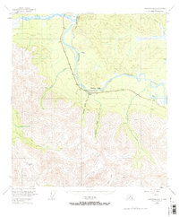
1949 Map of Tanacross B-6
USGS Topo · Published 1971About this map
The Tanana River cuts through the northern reaches of this Alaskan interior landscape, flanked by the prominent Tower Bluffs and Cathedral Bluffs. This survey, based on 1948 aerial photography and 1949 field annotations, documents the early infrastructure of the region following World War II. The Alaska Highway Pipeline runs roughly parallel to the river's south bank, serving as a vital artery through the wilderness.
Find a feature on this map
15 named features on this map. Tap any name to fly to it.
Don’t see what you’re looking for? This feature index may not catch every label — zoom into the map to look around manually.
Map Details
Editions of this 1949 Tanacross B-6 Map
3 editions found
Other maps of this area

1948 · Tanacross B-5
USGS Topo · 1:63,360

1948 · Tanacross A-6
USGS Topo · 1:63,360

1948 · Tanacross A-5
USGS Topo · 1:63,360

1949 · Tanacross
USGS Topo · 1:250,000

1949 · Tanacross A-5
USGS Topo · 1:63,360

1949 · Tanacross B-6
USGS Topo · 1:63,360

1949 · Mt. Hayes A-1
USGS Topo · 1:63,360

1950 · Tanacross
USGS Topo · 1:250,000

1950 · Mount Hayes
USGS Topo · 1:250,000

1951 · Mount Hayes
USGS Topo · 1:250,000